
Find Rancho Santa Margarita Neighbors
A block lookup combines geography, property, community, and civic records. The source determines what can be said about nearby parcels. For Rancho Santa Margarita neighbors, the city map shows adjacency. The assessment roll can show an assessed owner and mailing context. HOA information identifies an association or manager. Aggregate election data shows counts by city, district, and year. A permit or planning file shows a project at an address. None of these is a complete list of everyone nearby.
| Source | What it shows about a block | Access |
|---|---|---|
| RSM Community Viewer | Parcel geometry, APNs, HOA, districts, zoning, services, and visible adjacency | Free map; city verification recommended |
| Orange County Assessor | Assessed owners, mailing and situs fields, values, characteristics, possible exemption clue | Gateway, counter, or parcel inquiry |
| City HOA inventory | Association covering a community and official manager contact | Public contact list; no member roster promised |
| OC Vote Data Central | Aggregate registration by city, district, and year | Public aggregate |
| Permits and planning | Projects, applicants, work scope, and dates near the address | City request or counter, subject to exemptions |
| Qualified voter file | Address-level registration only for an approved purpose | Application, payment, and Elections Code limits |
The table separates block geography from personal identity. That separation is the central rule for Rancho Santa Margarita neighbors research.
Rancho Santa Margarita Parcel Neighbors
Use the Rancho Santa Margarita Community Viewer to search the target address or APN. Turn on property lines, then zoom until the individual lots are visible. Click the target parcel and record its APN. Pan to each immediately abutting parcel and record its APN separately. The viewer documents map browsing, not a bulk neighbor-owner report.
The exact adjacency flow is address to APN to property lines to touching parcel to separate APN to separate assessment query. For Rancho Santa Margarita neighbors, do not infer adjacency from house numbers alone. A corner lot, private road, irregular tract, drainage strip, or parcel behind a wall may not follow the street sequence.
Save the map date, layer names, and parcel notes. A block lookup is reproducible when another reader can see which lots were included and why.
Rancho Santa Margarita Neighbor Adjacency
Aerial imagery helps distinguish physical adjacency from a nearby address. It can reveal a corner lot, a private drive, a greenbelt, or a parcel whose access road is not the road named in its mailing address. The city map also provides HOA, school, water, zoning, land-use, fire-hazard, trash, and street-sweeping layers. In Rancho Santa Margarita, those layers explain how a block is administered without naming a household.
The city GIS disclaimer says data comes from several sources and may be incomplete or presented as available. Treat an aerial or boundary line as a research clue. Verify a property line, easement, or legal description with the county or city office before relying on it for a dispute or transaction.
Map discipline. Click the parcel, not the house. The parcel and APN are the record keys; the structure is visual context.
Note: Rancho Santa Margarita neighbor mapping identifies touching parcels, not every person who occupies them daily.
Rancho Santa Margarita Neighbor Ownership
The Orange County Assessor's roll can show an assessed owner, owner mailing address, situs, property characteristics, and possible exemption indicators. A matching mailing and situs address is consistent with owner occupancy, but it does not prove every person in the home. A different mailing address may reflect a trust, an entity, another location, or an address chosen for notices.
Recorded deeds add party names, legal descriptions, and transfers. They do not identify every neighbor. A permit can show an applicant, contractor, or owner-builder connected to work. It does not prove daily occupancy. For Rancho Santa Margarita neighbors, the Assessor contact page lists the Orange and Mission Viejo counters and routing numbers for property questions.
The Orange County Assessor contact page is the source shown in the neighbors property-record capture.
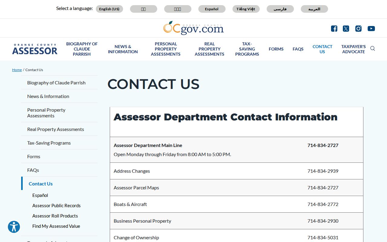
The Assessor contact view makes the counter fallback visible when a block question needs a county explanation rather than a web guess.
Rancho Santa Margarita Neighbors and HOA Map
Rancho Santa Margarita has a parallel community map. The official HOA inventory identifies SAMLARC, Dove Canyon, Rancho Cielo, Robinson Ranch, Trabuco Highlands, Walden, SAMCORP, and the Community Associations of Rancho. It supplies association or manager contacts, not a public member directory. Use the HOA layer in GIS to identify the association tied to a parcel before making a community-record request.
| Association or layer | Block-level use |
|---|---|
| SAMLARC | Core residential communities and parks west of Plano Trabuco Road |
| Dove Canyon | Eastern gated-community contact and private-street context |
| Rancho Cielo, Robinson Ranch, Trabuco Highlands, Walden | Named eastern communities with listed management contacts |
| SAMCORP | Nonresidential business and retail properties west of Plano Trabuco |
| Community Associations of Rancho | Emergency-planning coordination layer for city associations |
The city HOA inventory is the source for current manager and association contacts. Associations are private bodies and are not automatically subject to the California Public Records Act.
The official Rancho Santa Margarita HOA inventory is the source shown in the association capture.
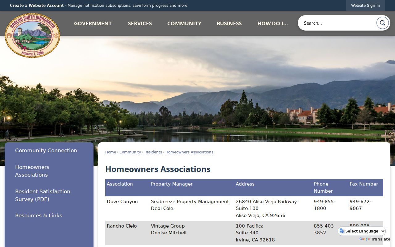
The official association page shows the community layer that a parcel map alone cannot provide.
Note: Rancho Santa Margarita HOA contacts identify governance and maintenance routes, not public member lists or rosters.
Rancho Santa Margarita Neighbors: SAMLARC
SAMLARC is the local block-level quirk. Emergency planning material describes the master association as covering residential communities and parks west of Plano Trabuco Road, with 99 sub-associations. That structure can explain why a city record is silent about a sign, light, gate, private road, traffic device, or security feature. The association may maintain it instead.
A neighborhood association can hold newsletters, board material, event photographs, project notices, and development history. It does not promise a public list of members. A request should ask for the association's own records and follow its rules. Do not assume that the manager's contact is a resident or that an association mailing list is public.
Rancho Santa Margarita Eastern Neighbors
Eastern communities have their own names and management contacts. Dove Canyon is listed with Seabreeze Property Management. Rancho Cielo is associated with Vintage Group. Robinson Ranch is associated with Powerstone Property Management. Trabuco Highlands is associated with Keystone Pacific. Walden is associated with Seabreeze. These contacts route community questions. They do not create a public neighbors directory.
Water geography also matters. Trabuco Canyon Water District serves eastern communities including Robinson Ranch, Trabuco Highlands, Dove Canyon, Rancho Cielo, and Walden. Santa Margarita Water District serves much of the remaining city. The GIS water layer can show which agency may hold infrastructure or project records, while customer account information remains private.
Rancho Santa Margarita Neighbors and Private Streets
Some associations maintain private streets, signs, lights, traffic devices, and security. That responsibility explains a common block-search gap: no city work-order record does not mean no maintenance record exists. The association may hold the relevant notice, vendor record, or board material.
Private association records are not automatically city records. Ask the association about its access policy, use the city HOA page to identify the right contact, and avoid requesting a membership roster. A resident directory should not be created by copying a private contact list.
Routing clue. If the feature is on a private road, check the association layer before treating a missing city file as a missing event.
Rancho Santa Margarita Neighbor Voter Context
California's voter-status tool is for the voter checking that voter's own registration. Elections Code section 2194 limits release of registration-card data to approved election, scholarly, journalistic, political, or governmental purposes. A qualified full-file request needs a purpose statement, wet signature, payment, supporting documentation, and delivery choice. The ordinary neighbor lookup cannot browse a street through that tool.
OC Vote Data Central offers a safer civic layer. It filters current and historical registration counts by city, district, and year. Select Rancho Santa Margarita for neighborhood-scale context without republishing individual names. Participation history means whether a voter participated, not ballot choices. A qualified requester can review the Orange County voter-data application route, but ordinary block research should use the aggregate option.
OC Vote Data Central is the aggregate alternative. The state voter privacy guidance explains why the individual list should not be republished. It does not identify neighbors, and it should not be converted into a block roster.
The OC Vote Data Central page is the source shown in the aggregate-neighbors capture.
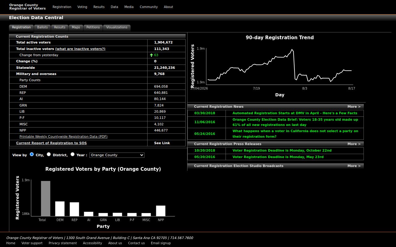
The aggregate data view demonstrates how civic context can be offered without exposing individual voter records.
Note: Rancho Santa Margarita aggregate voter data supplies civic scale while the individual registration file remains purpose restricted.
Rancho Santa Margarita Neighbor Block Permits
Development Services files can show building, electrical, heating, plumbing, demolition, grading, encroachment, planning, and code activity at nearby parcels. A permit may identify an applicant, contractor, owner-builder, plan set, project description, inspection, and final status. In Rancho Santa Margarita, a code case may show a site chronology and disposition, though complainant identity and investigative facts can be withheld.
Use the address, APN, project name, permit number, or date range in a city request. The city is the likely custodian for post-2000 municipal administration. Pre-incorporation work may be in Orange County systems. A project record describes a property event, not the identity of everyone on the block.
Rancho Santa Margarita Neighbor Limits
Official block tools and commercial neighbor tools answer different questions. Official sources are closer to the custodian but still narrow. Commercial tools may combine public records, marketing data, and inferred associations, then merge same-name people or stale addresses. Neither category should be treated as a complete or current household roster.
| Approach | Strength | Limit |
|---|---|---|
| GIS and parcel map | Shows physical adjacency and local layers | Does not show occupants |
| Assessor and deed records | Shows assessed or recorded ownership | Owner is not every resident |
| HOA contact | Identifies community governance | No public member list promised |
| Aggregate voter data | Shows civic counts and trends | No individual names or addresses |
| Commercial neighbor tool | May assemble leads quickly | Stale, merged, inferred, and not custodian proof |
Lawful use. Use Rancho Santa Margarita neighbor records for personal, lawful research and community context. Do not use them to stalk, harass, threaten, trespass, or defeat Safe at Home or another confidentiality protection.
The full named-street chain belongs in the Rancho Santa Margarita street directory. The neighbor lookup stays with the immediate block, parcel adjacency, HOA layer, and privacy boundary.